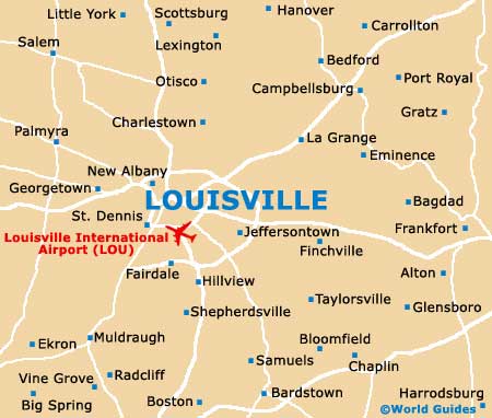
Louisville International Airport (SDF)
Orientation and Maps
(Louisville, Kentucky (KY), USA)
A laid back city in the state of Kentucky, Louisville is perhaps most famous for hosting the Kentucky Derby, which takes place each May in the Churchill Downs area. Based around the Ohio River, the city of Louisville also stands alongside the I-64 interstate and is surrounded by a series of impressive parklands, together with two main ring roads, the I-264 (inner ring road) and the I-265 (outer ring road).
Prominent landmarks to the south of the city center include the University of Louisville, Churchill Downs, the Kentucky Fair and Exposition Center, and Louisville International Airport (SDF). Close to Audubon Park and Lynnview, the airport lies off the I-65 interstate and is connected by local bus No. 2.
Louisville International Airport (SDF) Maps: Important City Districts
Located on the western side of downtown Louisville, the Greyhound bus station can be found along the West Muhammad Ali Boulevard and features regular buses to and from Chicago, Lexington and Nashville, amongst other cities. Local city buses operate at the Union Station depot along West Broadway and are run by TARC, which stands for the Transit Authority of River City.
Downtown Louisville consists of a compact gridwork of roads and many of the city's main attractions are centered around Main Street and the riverbanks. The Riverfront Plaza is a particularly popular area of the downtown district and features impressive views of the Falls of Ohio.
USA Map

Kentucky Map

Louisville Map